 vesseltracker.com
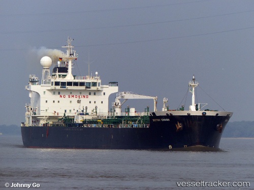
Vessel Coast Buster IMO: 9312913, MMSI: 311001723 Chemical/Oil Products Tanker
UTC, 34.43368, 33.48743, course: 196, speed: 6.6
UTC, 34.35800, 33.48827, course: 138, speed: 1.1
2026-01-31 13:21:51 UTC, 34.38153, 33.51763, course: 154, speed: 0.9
Live AIS position:
UTC. 22 nm SE of Vasilikos),
updated 2026-01-31 13:21:51 UTC.
Find the position of the vessel Coast Buster on the map. The latter are known coordinates and path.
marine traffic ship tracker show on live map
The current position of vessel Coast Buster is 34.38153 lat / 33.51763 lng. Updated: 2026-01-31 13:21:51 UTCCurrently sailing under the flag of Bahamas
Coast Buster built in 2006 year
Deadweight:
36713 tDetails:
Last coordinates of the vessel:
UTC, 34.50047, 33.52712, course: 280, speed: 0.7UTC, 34.43368, 33.48743, course: 196, speed: 6.6
UTC, 34.35800, 33.48827, course: 138, speed: 1.1
2026-01-31 13:21:51 UTC, 34.38153, 33.51763, course: 154, speed: 0.9